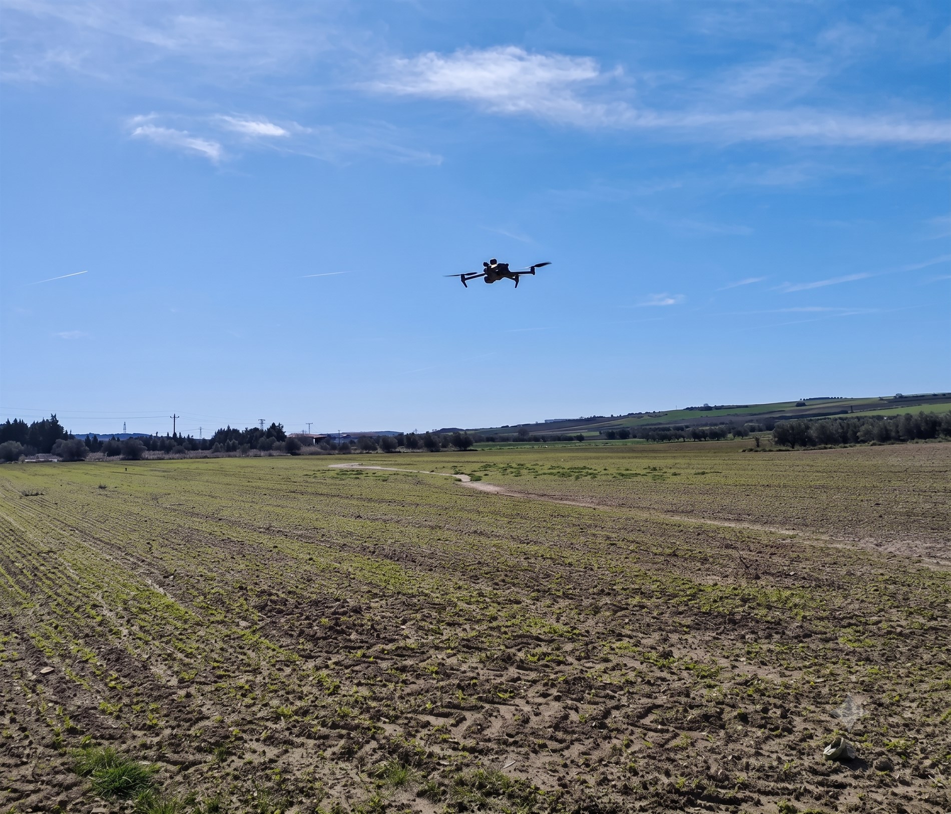
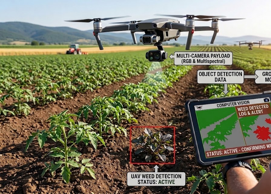
Concept illustration of the envisioned UAV-based crop and weed monitoring pipeline (illustrative — not a real system readout).
For precision agriculture, a common practice is to design crop monitoring and decision-support systems by combining advanced sensing technologies with computer vision methods for the accurate detection and segmentation of crops and weeds. In this context, unmanned aerial vehicles (UAVs) equipped with RGB and multispectral cameras have become a highly promising solution, as they enable non-invasive, high-resolution and large-scale monitoring of agricultural fields. RGB imagery provides detailed visual information about crop and weed appearance, while additional multispectral bands, such as near-infrared and red-edge, capture vegetation-specific characteristics that are particularly useful for distinguishing between crop plants, weed species and background soil. A UAV-based precision agriculture system should therefore provide accurate, robust and reliable information about field conditions, supporting tasks such as crop detection, weed identification and site-specific weed management. Such systems are especially important for crops such as maize, where timely and fine-grained weed detection can enable targeted interventions, reduce herbicide usage and improve overall crop productivity.
RGBMultispectral
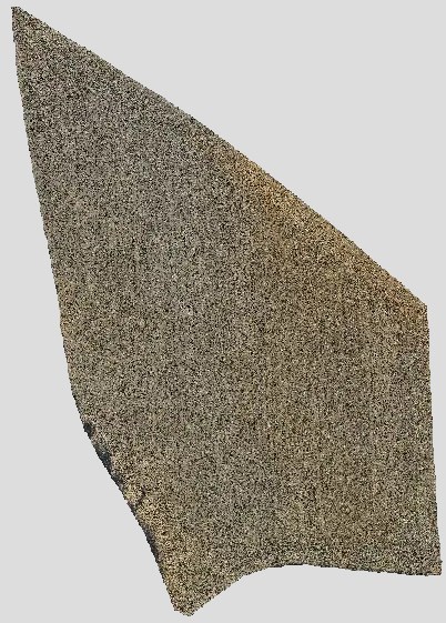
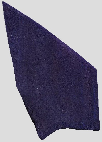
RGB and multispectral orthomap generation
The proposed approach is based on a photogrammetry pipeline, where UAV captured images are processed to construct a geo-referenced orthomap. The demonstrated resolution of this approach is down to 0.55 cm / pixel as Ground Sampling Distance (GSD) and relies on the UAV flight altitude and the camera intrinsic parameters.
RGBMultispectral
Vegetation indices
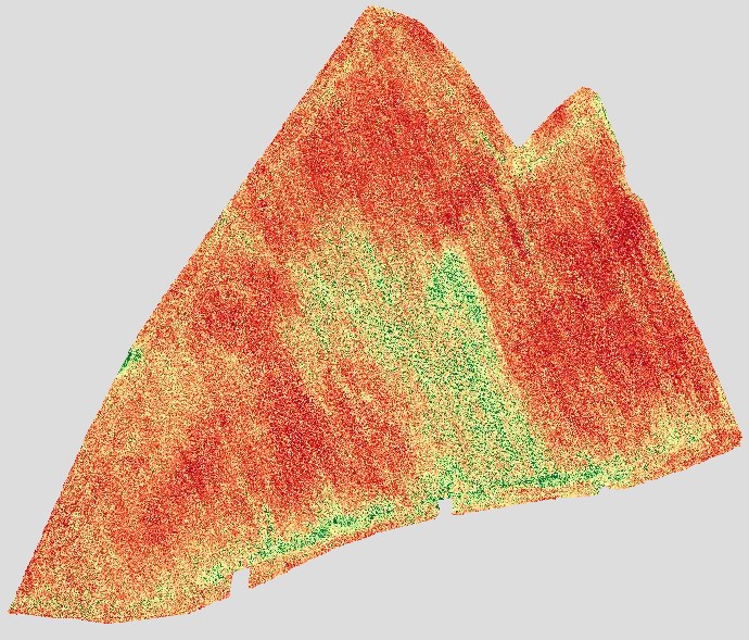
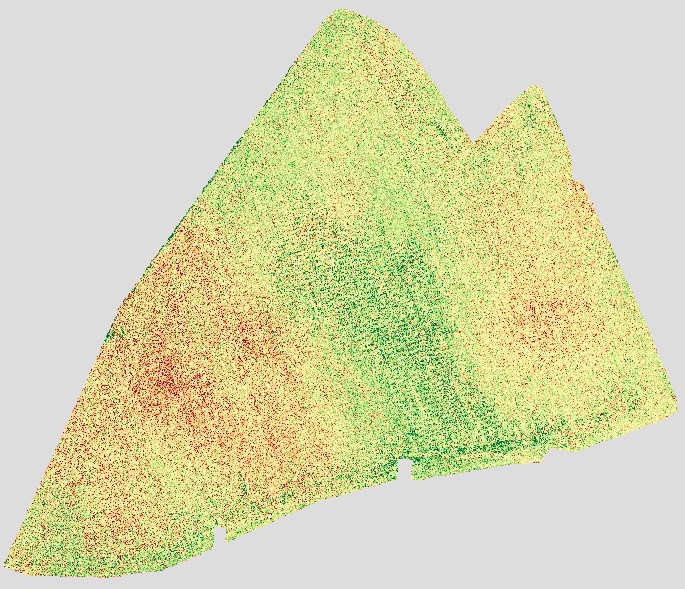
The proposed approach utilizes RGB and/or multispectral orthomaps to construct geo-referenced vegetation index orthomaps, to compute a holistic overview of the field. Depending on the type of initial orthomap, RGB and/or multispectral, specific vegetation indices may be computed to monitor deficiencies or growth phases of specific crop types. The left image is derived from RGB and the right image from multispectral (MS).
Multispectral crop and weed 2D object detection
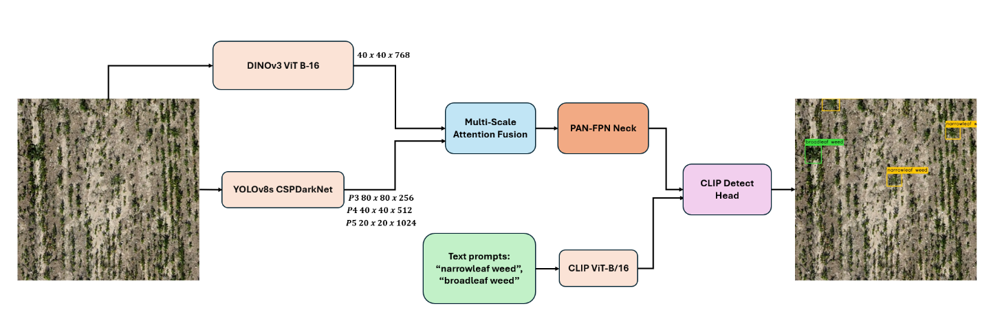
The proposed approach is based on multispectral 2D object detection for precision agriculture, where crops and weeds should be accurately detected in UAV-based orthomaps. The contribution of the proposed methodology is to improve the 2D object detection of crops and weeds, by integrating multispectral sensing with foundational vision and vision-language models, via a Multi-Scale Feature mechanism, into existing low latency and real-time typical 2D object detectors, such as YOLOv8s.
Multispectral crop and weed semantic segmentation
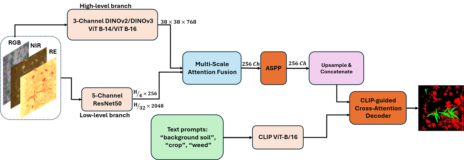
The proposed approach is based on multispectral semantic segmentation for precision agriculture, where crops and weeds should be accurately segmented from UAV-based imagery in order to support site-specific weed management and targeted agricultural interventions. The contribution of the proposed methodology is to improve the robustness and generalization ability of crop and weed segmentation by integrating multispectral sensing with foundational vision and vision-language models, aiming to exploit both spectral vegetation information and high-level semantic guidance. More specifically, the method combines a ResNet50 backbone adapted to 5-channel multispectral input with DINOv3 visual representations, a multi-scale attention fusion mechanism and a CLIP-guided cross-attention decoder, demonstrating state-of-the-art performance on the WeedsGalore dataset while effectively handling challenging field conditions, class imbalance and fine-grained weed species recognition.
Related publicationI. Papadeas, G. Sandalis, G. Zamanakos and I. Pratikakis, “CLIP Meets DINOv3 for Effective Crop and Weed Multispectral Semantic Segmentation,” Computer Vision Conference 2026, Amsterdam, Netherlands, 21–22 May 2026, Lecture Notes in Networks and Systems, Springer.
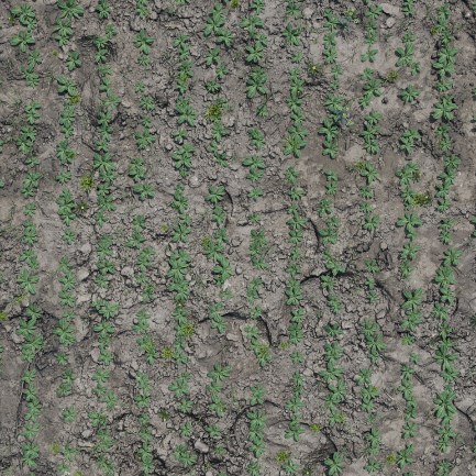
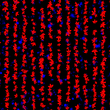
Synthetic renderGenerated mask
Synthetic data from agriculture scenes for semantic segmentation & object detection
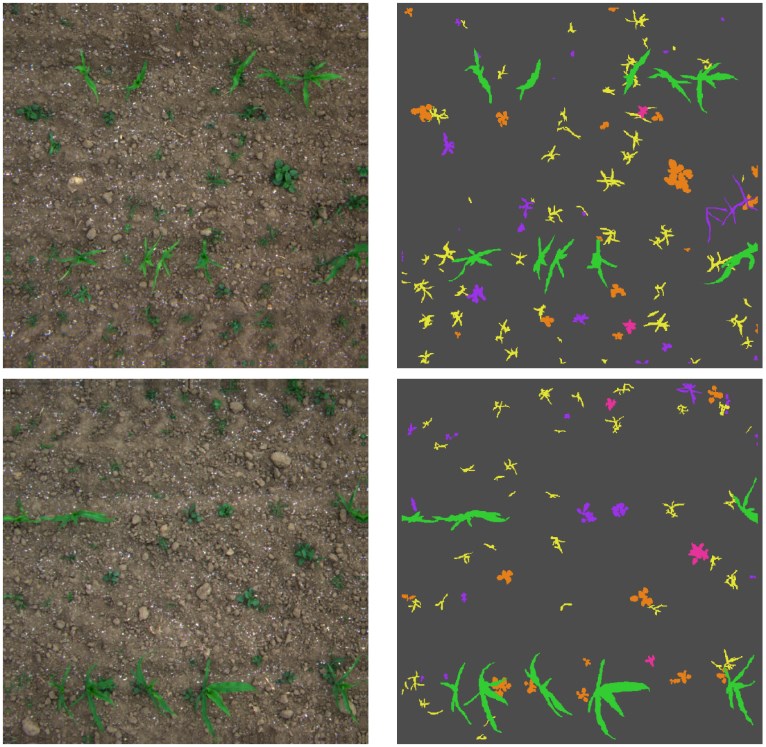
The proposed approach is based on the creation of open synthetic datasets for precision agriculture, where realistic digital replicas of agricultural fields are generated in order to support robust crop and weed detection under diverse and challenging field conditions. The contribution of the proposed methodology is to reduce the dependence on costly and time-consuming real-world data collection and manual annotation by integrating photorealistic 3D field simulation, parametric environmental variation and automatic label extraction within a controlled synthetic data generation pipeline. More specifically, the method extends a CropCraft-based Blender environment with HDRI illumination maps, physically based rendering of realistic soil textures, detailed 3D modelling of camelina plants through image-based reconstruction with TRELLIS 2.0 and NanoBanana Pro, and automated generation of semantic masks and bounding boxes. The resulting dataset consists of 1,300 high-resolution synthetic images representing camelina and weeds across multiple viewpoints, lighting conditions, growth stages and visibility scenarios, providing accurate annotations for both semantic segmentation and object detection while improving dataset scalability, label quality and model generalization for downstream agricultural vision tasks.